By Jaime Martindale, Map & Geospatial Data Librarian
Resources for Sharing and Discovering Geospatial Data
Geospatial data is digital geographic content that represents or describes features/phenomena on the earth. It’s useful because it gives us the ability to layer different types of information to see what is occurring in a specific area of the world, then analyze or model spatial relationships or patterns. Researchers looking to make their geospatial data more broadly accessible have several close-to-home options including: GeoData@Wisconsin (focusing on Wisconsin-specific data) and the B1G Academic Alliance Geoportal. Users looking for data to use in research, teaching or general-interest mapping can discover new sources of geographic information in these online geoportals.
Success in locating geospatial data online means users need the ability to search for it spatially – i.e. via a map. This is one concept that gets complicated when relying on traditional data repositories that lack some form of geographic discovery. The term ‘geoportal’ is used for an online source that allows for this geographic search, discovery, and access.
GeoData@Wisconsin: geodata.wisc.edu
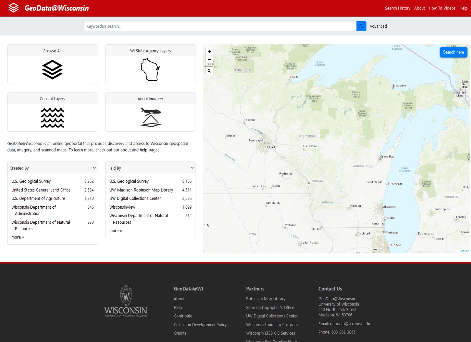
Here at UW-Madison (and specifically, the Robinson Map Library) we collect and archive Wisconsin geospatial data and assist with metadata creation to promote discovery and access online. Each year, Wisconsin counties submit foundational data layers (important for infrastructure and tax parcel mapping) to the library for documentation and inclusion in GeoData@WI. The goal is to begin to develop a digital historical archive that shows changes in Wisconsin’s landscapes through time.
In the same way we can research how places historically appeared using paper maps and aerial photos, we recognize the same must be true for born-digital depictions of our state’s roads, buildings, land use, water features, land ownership, parks, trails, and other recreational/tourist facilities. We have a strong interest in capturing and archiving geospatial data created on the UW campus. A few examples include the UW Forest Landscape Ecology Lab’s geospatial data representing features from the 1930s Wisconsin Economic Land Inventory (Bordner Survey), and coastal data from UW Sea Grant’s Coastal Atlas.
B1G Geoportal: geo.btaa.org
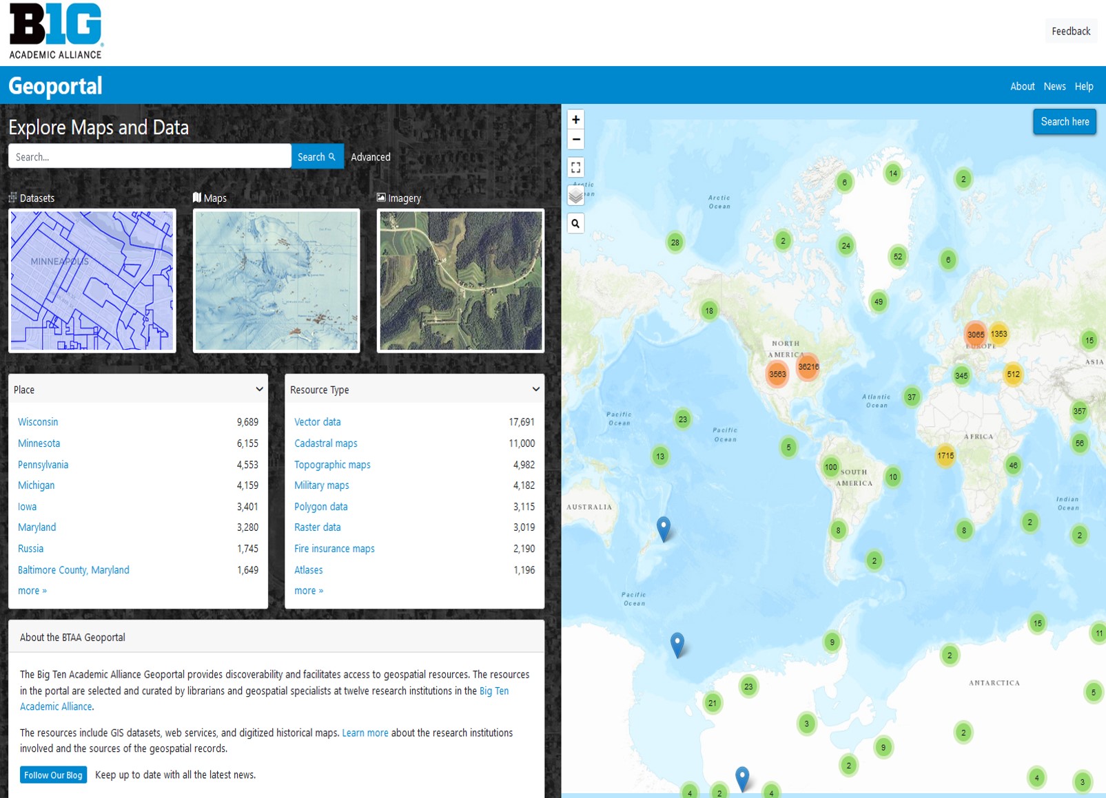
Thirteen academic institutions participate in the B1G Academic Alliance Geoportal – in an effort to provide a single stop for geospatial data, scanned maps, and aerial imagery from BTAA library collections and other sources. These data resources span the globe in their geographic coverage. There are some amazing opportunities to discover university research data, unique georeferenced scanned maps, and licensed research resources specializing in geospatial or map content. The hotspots on the map in the image above show the number of available data or map resources in the geoportal around the world. An easy way to find information for a particular area of interest is to dive into the map!
Whether researchers are looking for geospatial data online or have a desire to share their own more broadly, Robinson Map Library staff can offer guidance on metadata creation and providing access online via the geoportals described here. Contact librarian Jaime Martindale for more information.